Itinerary in the Médio Tejo Region
- Catarina Araújo

- May 29, 2025
- 13 min read
Updated: Jun 3, 2025

The inspiration for this month's Quimera GPS article comes from a trip we took in May 2019 to the Médio Tejo (Middle Tagus) region. It was a memorable experience full of discoveries, so we're sharing our suggestions here for a 3-day itinerary in this area of central Portugal.
Day 1 — From Golegã to Constância: A Dive into the Soul of the Médio Tejo
Golegã
We chose Golegã as our overnight stop, staying at a pilgrim hostel. Yes, it's true — the Central Route of the Camino de Santiago passes through here, making this village an interesting stop for those following this ancient path.

Capital of the Horse
Golegã is known as the Horse Capital of Portugal, famous for the National Horse Fair — an annual event that draws thousands of visitors and equestrian culture enthusiasts. During the fair, the village comes alive with competitions, auctions, and demonstrations that celebrate its deep-rooted horse traditions.
Cultural Tourism: Carlos Relvas
One of the most iconic figures of Golegã is Carlos Relvas, a 19th-century photographer and inventor. His cultural legacy is preserved at the Carlos Relvas House-Studio, where visitors can learn more about the life and work of this photography pioneer in Portugal, as well as admire the unique atmosphere of his studio — which still houses the original equipment.

Literary Tourism: José Saramago
Not far away, in Azinhaga, we find the José Saramago Foundation, dedicated to preserving the memory of the Portuguese Nobel Prize-winning author. For literature lovers, visiting this place is an opportunity to dive into the author’s world and learn more about his deep connection to this region of Médio Tejo.
Nature Tourism: Paul do Boquilobo Nature Reserve
For nature enthusiasts, the Paul do Boquilobo Nature Reserve is a crucial protected area in Médio Tejo. Internationally recognized, this wetland hosts a great diversity of birds and is a paradise for wildlife watchers. Walking along its boardwalks and observing the ecosystem is a relaxing and enriching experience.
Almourol Castle
After discovering the unique culture and nature of Golegã, continue your journey to another icon of Médio Tejo: Almourol Castle. This medieval castle, which rises on a small island in the middle of the Tagus River, will transport you straight into history and is one of the most emblematic and fascinating monuments in Portugal.
Located on a small island in the Tagus River, Almourol Castle is one of Portugal’s most iconic medieval monuments and an important symbol of the Templar presence in the country. Built in the 12th century, it stands out for its Templar military architecture, featuring high walls, nine circular towers, and a three-story keep.
Its history dates back to ancient occupations, possibly Lusitanian or pre-Roman, but it was in 1129, after the conquest by the Portuguese, that the castle began to take its current form, especially after being handed over to the Order of the Templars, who rebuilt it.
In the 19th century, Romanticism valued and restored the castle, adding decorative elements. In the 20th century, it served as the official residence of the Portuguese Republic during the Estado Novo regime.
The castle has been a National Monument since 1910 and, in 2013, was elected the "Star of Médio Tejo" in the Built Historical Heritage category. Today, it is possible to visit it by boat from Praia do Ribatejo or the Tancos Dock, and also to visit the Templar Interpretation Center in Vila Pouca da Barquinha.


Visiting Hours:
From March to September: 9:30 AM – 1:00 PM and 2:30 PM – 6:30 PM
From October to February: reduced hours, closed on Mondays
Prices:
Boat crossing: €4 per person
For bookings and information about tours, contact the Tancos Parish Council.
And if you want a different perspective of the castle, why not try a kayak trip on the Tagus River? Paddling in the calm river waters, with Almourol Castle appearing ahead on a small island, is a unique way to experience this magical place. Several local companies organize these activities, making it a great way to add more adventure to your itinerary in Médio Tejo.
Constância, the Poem Town
After Almourol, continue your journey to Constância, a small but charming town located at the confluence of the Zêzere and Tagus rivers.
Known as the "Poem Town," Constância has a strong connection to literature, especially linked to the name of Luís de Camões, author of Os Lusíadas.

According to local tradition, Camões is said to have lived here for some time in the 16th century, possibly before departing for India. It is believed that he may have been exiled or took refuge in the town for love or political reasons — there are no absolute historical certainties, but the legend is part of Constância’s identity. The Casa dos Arcos, also known as Camões House, is a symbol of this cultural and literary connection. Even today, it is visited by those who wish to follow in the poet’s footsteps.
With its flower-lined streets, viewpoints overlooking the rivers, and a serene atmosphere, Constância invites visitors for a stroll through its Historic Center and the Constância Riverside Beach.


Take a stroll through the Historic Center, where white houses with colorful baseboards, flower-adorned windows, and narrow alleys make you feel as if you’re in a village straight out of a postcard.
Visit the Church of Constância, with medieval origins and a privileged view over the town and rivers, and the Casa Memória de Camões, located next to the supposed Casa dos Arcos, where you’ll find a small exhibition space celebrating the life and work of the poet.


After the walk, there’s nothing better than relaxing by the water at Constância’s Riverside Beach, right where the Zêzere meets the Tagus. It’s a well-maintained spot with shaded areas, lawns, a terrace, and a small pedestrian bridge connecting to the opposite bank. A perfect place for a swim on hotter days or simply to lay out your towel and relax while enjoying the river view.


Constância Living Science Center – Astronomy Park
Part of the national network of these centers, here science comes to life through a strong connection to astronomy and contact with nature.
The center offers several unique experiences: an observatory with five domes and high-precision telescopes, a planetarium, a holography lab to create 3D images, and outdoor modules of our Solar System, our Galaxy, the Jupiter and Saturn systems, the Sun-Earth-Moon system, and the Celestial Sphere.
Fluviarium of the Zêzere River Mouth
Just a few minutes from the center of Constância, in the building of the Constância Nautical Center, at the confluence of the Tagus and Zêzere rivers, is the Fluviarium of the Zêzere River Mouth. This is a space dedicated to the biodiversity of Portuguese and international rivers.
Here you can observe up close various species of fish and other aquatic creatures that inhabit rivers, lakes, and wetlands, along an engaging and educational route. The fluviarium stands out for its commitment to conservation and environmental awareness, making it ideal for families and nature lovers.
In addition to the exhibition tanks, the facility offers leisure areas, a playground, and a picnic area, making the visit a relaxing and fun experience. Don’t miss the opportunity to discover this natural spot that perfectly complements your visit to the Médio Tejo region.
Tropical Butterfly House – Santa Margarida Environmental Park
If you want to experience something out of the ordinary, the Tropical Butterfly House at Santa Margarida is a must-visit. Located in the Santa Margarida Environmental Park, this space transports you to an exotic, warm, and humid environment where tropical butterflies freely flutter among the vegetation.
Here, you have the opportunity to observe up close various species of butterflies — some quite large — and discover interesting facts about their biology and ecology.


Visits to the butterfly house are by appointment only, so it’s best to plan ahead. But it’s definitely worth it!
The Santa Margarida Environmental Park is an environmental education space covering about 6 hectares, where you can explore trails, green areas, and thematic zones dedicated to nature and sustainability. It’s an ideal place for a family outing or simply to relax while connecting with nature in a peaceful and well-maintained environment.
Day 2 — Between the History of Tomar and the Nature of Agroal

After a first day full of discoveries in Constância and its surroundings, get ready to immerse yourself in the grandeur of Tomar, one of the most remarkable cities in Portugal’s history. On this second day, you will follow the paths of the Templars, marvel at unique monuments, and finish with a well-deserved dip in the refreshing nature of Agroal.
Tomar
Convent of Christ and Templar Castle

Early in the morning, get ready for one of the most impressive visits in the Médio Tejo region: the Convent of Christ in Tomar.
This monument, classified as a UNESCO World Heritage Site, is much more than just a building – it’s a deep dive into the history of Portugal, from the times of the Knights Templar to the Manueline period.
The entrance is through the walls of the old Templar Castle, founded in 1160 by Dom Gualdim Pais, master of the Order of the Temple. Its strategic location allowed for surveillance of the Nabão River and protection of the territory recently conquered from the Moors.
The convent that rises within is a true gem of Portuguese architecture.
Stroll through the Renaissance cloisters, explore the Charola – the former Templar church with its octagonal layout inspired by the Holy Sepulchre in Jerusalem – and admire the intricate details of the Manueline Window, one of the greatest icons of Manueline art.
Pegões Aqueduct

After calmly exploring the Convent of Christ, head to the Pegões Aqueduct, an impressive feat of 17th-century hydraulic engineering built to supply the convent with fresh water from the nearby hills.
Stretching for about 6 kilometers, this aqueduct crosses deep valleys with towering arches, some over 30 meters high. Its grandeur is striking from a distance, but it’s also possible to climb to the top and walk along part of the structure – a unique experience that offers magnificent views over the rural landscape surrounding Tomar.
It’s one of those places where architecture blends with nature – perfect for a short walk and some great photos.
📍 How to get there: The aqueduct is about 3 km from the Convent of Christ. You can reach it by car in less than 10 minutes, or on foot in about 30 to 40 minutes. The walking route follows the road, with a few gentle climbs — note that there are sections without sidewalks. For convenience, search for "Aqueduto dos Pegões Altos" on your GPS.
Did you know that you can walk along the top of the aqueduct?
It’s a unique experience in Portugal, offering incredible views over the Ribeira dos Pegões valley and the city of Tomar.
The visit is free and open to the public, so you can go whenever you like. Just make sure to wear proper footwear and check the weather, as the path can be uneven and the aqueduct is 30 meters high. If you’d like, you can also book a guided tour to learn all about its construction and historical significance — just contact the Tomar city council.
Mata Nacional dos Sete Montes – A Green Refuge in the Heart of Tomar
Just a few steps from the historic center, the Mata Nacional dos Sete Montes (Seven Hills Forest), is the ideal place to take a break, relax, and have a picnic.
This natural oasis in the heart of Tomar covers a vast wooded area of about 39 hectares, featuring several trails and historic spots. More than just a green space, the forest is also a landscape and Cultural Heritage Site. Highlights include the elegant Charolinha, a small stone temple surrounded by a pond, and the well-maintained French Boxwood Gardens. Another intriguing point is the mysterious Gruta do Sangue (Blood Grotto), linked to legends of ancient battles and surrounded by symbolic interpretations.


The origin of the name "Mata dos Sete Montes" is linked to the local geography: the valley where the forest now stands was once surrounded by seven hills arranged in a horseshoe shape, opening towards the Nabão River. This valley, also known as Vale da Riba Fria, was acquired in the 16th century by order of King John III to be incorporated into the Convent of Christ, serving as a place of retreat and cultivation for the monks of the Order of Christ.
Entry is free, and access can be made on foot from the city center.
Opening Hours:
Summer (April to October): 8:30 AM to 7:30 PM (last entry at 7:00 PM)
Winter (November to March): 8:30 AM to 5:30 PM (last entry at 5:00 PM)
Closed: January 1, Easter Sunday, May 1, and December 25.
Agroal
Located on the border between the municipalities of Ourém and Tomar, Agroal is a small village known for its cold, crystal-clear waters, surrounded by legends of healing properties. The Agroal spring — one of the largest karst springs in the region — flows from a limestone escarpment next to the Nabão River and supplies the famous Agroal River Beach, a popular spot during the warmer months.


Agroal Canyon Route
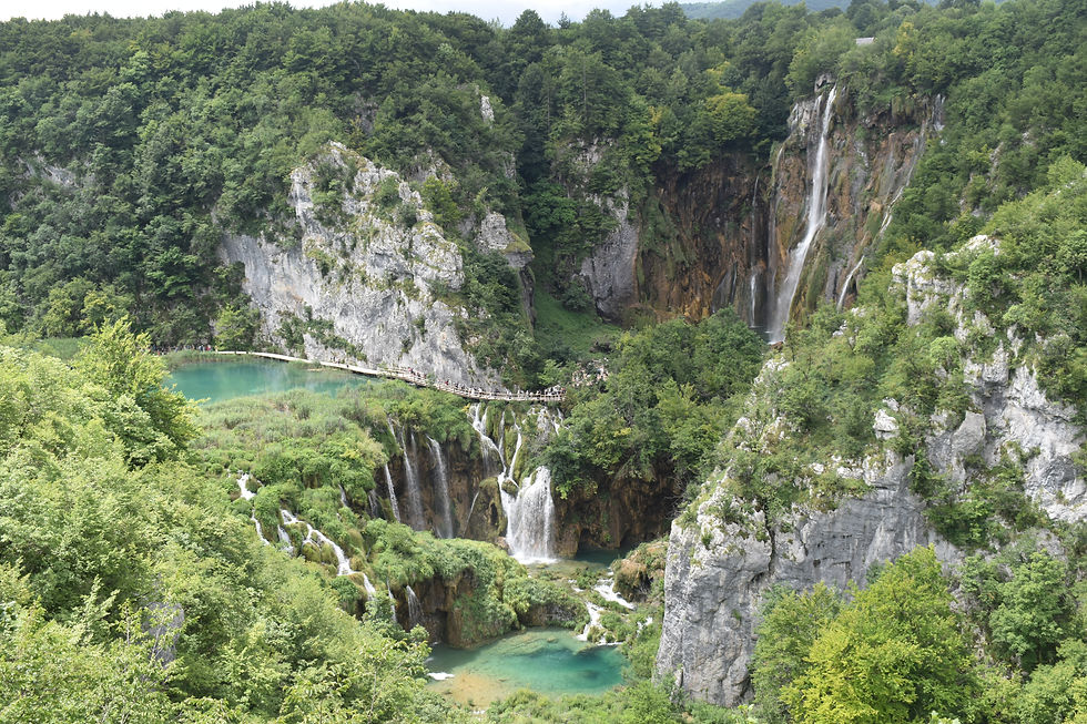
For those who enjoy hiking, the Agroal Canyon Route is an excellent way to explore this unique landscape. With a total length of 12.2 km (round trip), the trail runs along the Agroal hillside and offers stunning views of the Nabão fluvio-karst canyon.
The route starts at the Agroal river beach, on the right bank of the river, and descends eastwards via staircases on a boardwalk, crossing rural paths and stretches of dense vegetation. From there, you walk another 120 meters on the boardwalk until entering a protected forest area, part of the Natura 2000 Network. The trail crosses a municipal road and continues through a large eucalyptus plantation until reaching areas of scrubland and olive groves, then descends to the Sabacheira stream. From this point, the trail turns east, following the stream until it meets the course of the Nabão River again.
Along the route, the contrast between the Mediterranean vegetation and the limestone escarpments creates a rich visual experience, ideal for nature lovers as well as geology and photography enthusiasts. Although the trail is not difficult, it is advisable to wear appropriate footwear and bring water, especially during the warmer months.
Day 3 – Vila de Rei, the Geodetic Center of Portugal
On the last day of this itinerary, we head to Vila de Rei, a peaceful town in the heart of Portugal, known for hosting the country’s geodetic center. Here, nature and geography come together to offer panoramic views, surprising trails, and places of pure relaxation, such as the Penedo Furado River Beach. It’s a day to take a deep breath, walk among waterfalls and pine forests, and literally contemplate the Portuguese territory from its central point.
Geodetic Center of Portugal

Just 1.8 km from Vila de Rei, on the road towards Sertã, there is a well-signposted turnoff to Picoto da Melriça, the exact point marking the Geodetic Center of Portugal. From there, it’s only another 900 meters to reach the spot that symbolically represents the center of mainland Portugal.
Situated at an altitude of 600 meters, this natural viewpoint offers a 360º panoramic view, allowing you to see the Serra da Lousã and, on clear days, even the imposing Serra da Estrela, nearly 100 km away.
Also located here is the Geodesy Museum, an interactive space that complements the visit with a thematic exhibition about land measurement, a small auditorium, a souvenir shop, and a café.
More than just a geographical landmark, this is a place for contemplation and discovery, symbolically representing the balance and centrality of the Portuguese territory.
Penedo Furado River Beach + Penedo Furado Walkways
The next stop on our itinerary is one of the most iconic and charming spots in Vila de Rei: the Penedo Furado River Beach. Nestled among rocks, lush vegetation, and unusual geological formations, this beach is known for its clear, fresh waters—perfect for a swim on hot days. It is equipped with a swimming area, picnic zone, a support bar, and lifeguard surveillance during the bathing season.


Just a few steps away begin the Penedo Furado Walkways, a wooden trail that winds along the Codes stream, a tributary of the Zêzere River, offering stunning views over the valley and its rock formations.


The trail was extended in 2021 and now stretches for about 2 km through places of rare beauty, highlighting the Penedo Furado Waterfall, the Penedo Furado Grotto, the Painted Snake fossil, the Fragas do Rabadão Viewpoint, and the Penedo Furado Viewpoint.
At the latter, there is a gigantic rock with a huge funnel-shaped opening, which gave the beach its name. From this higher area, it is possible to admire a magnificent landscape that includes mountains and hills covered with pine forests, the Codes stream, the reservoir of the Castelo do Bode Dam, and some houses of the nearby villages.
Hiking
For hiking lovers, Vila de Rei offers trails that cross landscapes of great beauty and diversity. Here are two suggestions that allow you to discover the municipality on foot.
Feel free to adapt the itinerary to your preferences, availability, and physical condition, ensuring a personalized and enjoyable experience.
PR1 – Waterfalls Trail
The Waterfalls Trail is a circular short route (Pequena Rota) starting and ending in the center of Vila de Rei. It follows three waterways — the Lavadouro stream, the Vale Feito stream, and the Vila stream — creating an itinerary rich in biodiversity and full of natural charm.
Along the trail, the steep valleys and the continuous action of the water have created several waterfalls and natural pools, forming small refuges of coolness and beauty. The route crosses rocky areas, dense forests, and riparian vegetation zones, providing a varied walk with shaded sections and more open stretches where it’s possible to enjoy wide views of the surroundings.
DISTANCE: 10 km
DURATION: 4 hours
DIFFICULTY LEVEL: Medium/High, with steep elevation changes
Points of Interest:
Lavadouro Spring
Water Mills
Bicarola Waterfall
Poios Waterfall
Areal Mines
Mourisca Road
Tip: Bring water, appropriate footwear for rugged trails, and, if possible, hiking poles. If you visit in spring or after rainy days, the waterfalls will be at their best.
PR3 – Bufareiras Trail
The Bufareiras Trail is a short linear route that connects the center of Vila de Rei to the Penedo Furado River Beach, revealing surprising landscapes marked by impressive rock formations, narrow valleys, and small streams that create several waterfalls.
The trail begins near the Vila de Rei cross, an elevated spot offering a wide view over the town. From there, the path leads hikers along old rural roads, crossing areas of Mediterranean vegetation until reaching the Bufareiras area.
Arriving at the Penedo Furado River Beach makes the journey even more rewarding, allowing for a well-deserved rest by the water.
The combination of geology, vegetation, and the presence of water creates scenes of great natural beauty, making this trail one of the most appreciated in the region.
DISTANCE: 10 km
DURATION: 4 hours
DIFFICULTY LEVEL: Medium/High, with steep elevation changes
Conclusion
In just three days, this itinerary through Médio Tejo reveals the surprising diversity of the region — from the Templar heritage of Tomar to the natural landscapes of Vila de Rei, passing through the peaceful corners along the banks of the Zêzere River. Between historic villages, trails by waterfalls, enchanted forests, and breathtaking viewpoints, each stop offers a new perspective on the cultural and natural wealth of central Portugal.
It is an invitation to slow discovery, where time is measured in steps taken, fresh dips, and lingering gazes over the landscape. Ideal for those seeking to combine nature, history, and tranquility, this itinerary is just a starting point — because Médio Tejo has much more to reveal to those who return with time and curiosity.


Comments