Lagos - the City of Discoveries
- Catarina Araújo

- Sep 4, 2023
- 20 min read
Updated: Jan 22

This post is dedicated to the city of Lagos, a city whose history takes us back to the era of maritime discoveries.
The magnificent beaches of the Costa D'Oiro (Gold Coast), the historic center, the culture, the heritage, the hiking trails, the vibrant artistic life, the nightlife and gastronomy, are some of the reasons why choose this destination for a holiday or a “getaway”.
Come with us to get to know this city, which never ceases to enchant its visitors, making them come back again and again.
History
Several archaeological studies point to 2000 BC as the time of the origin of the settlement of Lagos. The name Lacobriga is of Roman origin, and is thought to be associated with the large number of lakes that were formed in this region.
The wealth of fish attracted various peoples in the Iron Age, such as the Phoenicians, Greeks and Carthaginians, making it a very prosperous center. During the Roman era, Lacóbriga became a very important settlement for the empire, with several population centers along the bay of Lagos. Muslims occupied it from the 8th century onwards and named it Zawiya. These people built walls and fences for their protection, due to the strategic importance and privileged location of access to Silves, the capital of the entire Andalusian kingdom. In 1249 it was conquered from the Moors by D. Paio Peres Correia. During the reign of D. Afonso IV the walls were rebuilt and the Military Government of the Algarve established itself here.
It was during the reign of D. João I (1385 - 1433), that the town reached the peak of its importance, becoming the basis for the Discoveries. Due to its location facing Africa, for 40 years navigators left here to explore the African continent, starting a trade in exotic goods, ivory and gold. At this time many churches were built and the city grew with the establishment of many merchants. In 1573 D. Sebastião promoted Lagos to a city.
The earthquake and tsunami of 1755 destroyed a large part of the city, which only recovered its prosperity from the mid-19th century, with the establishment of several canning factories.
Itinerary to visit Lagos
Lagos Marina
We suggest starting the itinerary at Lagos Marina. Here you can find several terraces, cafes and restaurants where it's great to enjoy a drink or a meal while enjoying the views.
The Lagos marina began operating in 1994 and since then has been visited by more than 40,000 boats from all continents and more than 100 different nationalities.
Suggestion: you can get to Lagos Marina by train; It's a beautiful trip where you can admire the views of the Alvor Stream and Meia Praia.
Cross the pedestrian drawbridge towards the center of Lagos and continue your walk along the Ribeira de Bensafrim, along Avenida dos Descobrimentos (Discoveries Avenue), where there are several street vendors.

Caravel Boa Esperança
Anchored at the Ribeira de Bensafrim Pier, is the Caravela Boa Esperança. This vessel is a replica of the Portuguese caravels used in the epic of Discoveries. Its name comes from the Cape folded in 1488 by Bartolomeu Dias - the Cape of Good Hope or Cape of Storms.
The Caravela Boa Esperança was manufactured in Vila do Conde with the aim of serving for sea and sailing training and for participating in races and other nautical events. In 2001 it was acquired by the Algarve Tourism region and docked in Lagos. Since then, it has served the purpose of promoting the history of the Algarve, traveling long nautical miles around the world. It has also served as a setting for films and documentaries and has received many tourists and students for guided tours about the lives of Portuguese sailors at the time.
Its sails bear the symbol of the Cross of Christ, of whose order Henry, the Navigator was regent. The Infante's weapons can be seen on the main mast.
At the time of writing this post (August 2023) it is not yet possible to visit the Caravela Boa Esperança Interpretive Center, but it will soon be reopened to the public.

Lagos Municipal Market
The Lagos Municipal Market, or Mercado da Avenida, is a little further along this avenue and is open from Monday to Saturday, from 8am to 2pm.
This market is worth visiting for its stalls full of color, the fish just arrived from the sea, the fresh products and the hustle and bustle of Lagos inhabitants and tourists making their purchases.
The building was built in 1924 and restored in 2004. In this restoration it received an admirable tile panel by the artist Xana and an evocative panel by the author Sofia de Mello Breyner Andresen, where you can read her poem “O Caminho da Manhã” ("The Morning Path"), with reference to this market.
On the 1st floor there is a restaurant and a terrace with a magnificent view of the bay of Lagos.

Gil Eanes Square
In the center of Praça Gil Eanes there is the statue of King D. Sebastião by the sculptor João Cutileiro.
This square, located in the city center, is very busy and you can often find a lot of street entertainment, such as musical shows and street vending.
Here you can find the old Paços do Conselho building, built in 1836 to house the Lagos City Council. This structure had been destroyed by the earthquake. It is currently the headquarters of the Municipal Assembly and has a large hall and rooms for temporary themed exhibitions. Downstairs, you can find a Police office, a tourist information desk and the Lagos Municipal Photo Library.
In ancient times, the taps that supplied water to the city's water carriers were located here. After an intervention, the spouts were removed.

Continue strolling through the streets of Lagos towards the Historic Center, along the typical Barroca Street.
Barroca Street
Until 1960, Barroca Street was separated from the Bensafrim river by the wall. Nowadays, it is one of the most typical streets in Lagos, due to its arches.Archaeological excavations found here evidence of the existence of a Phoenician settlement dating back to the 8th century BC.
Go up Barroca Street, passing by the old Military Hospital, which is now the Messe Militar, to Praça do Infante. Look at the walls adjacent to the underground car park, where you can find several marine fossils that testify the presence of the ancient coastline.
Infante D. Henrique Square
The Infante D. Henrique Square is the main square in Lagos, where the statue of Henry the Navigator stands. Here you will find several historic buildings such as the Slave Market, where the Slavery Route Museum Center was inaugurated, the Church of Santa Maria (or main church), and the Regimental Warehouse.
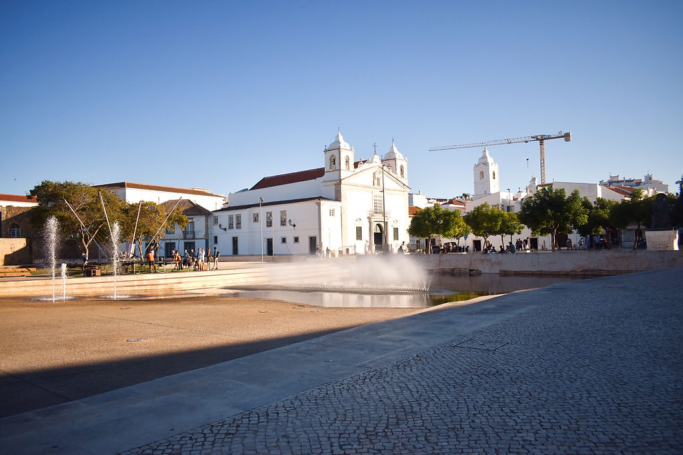

Before being Praça Infante D. Henrique, this square had other names: Bull Square, Pelourinho Square, County Square, Constitution Square and Republic Square.
In the center of the square is the statue of Henry the Navigator, inaugurated in 1960, on the 500th anniversary of his death. In his hands is the sextant, an instrument used for maritime navigation, long before the invention of GPS.
Henry the Navigator was an important figure at the beginning of the Age of Discoveries. He was responsible for the initial development of maritime exploration. When he realized that the Algarve had a strategic position close to Morocco and had a workforce experienced at sea, he began to stay longer and longer in the Algarve, bringing his scientific and nautical knowledge and recruiting men for his trips to the coast of Africa.
In 1419, his father appointed him governor of the province of Algarve. At this time, countless African goods and also slaves arrived at the port of Lagos.
Slave Market
This museum center highlights some aspects of the slave trade that took place in Lagos in the 15th century, inviting us to reflect on this dark chapter in our history.
“Considered the greatest tragedy in human history, due to its duration and scope, and also a strange form of globalization, the slave trade caused, on a global level, profound transformations that explain, in part, the geopolitical and socio-economic configurations of the contemporary world".
Slave Route, Unesco, 2006
Excavations in an old municipal dump in the city, in connection with the construction of an underground car park, led to the discovery of more than 150 human skeletons, which studies have proven to be African individuals brought to Lagos as merchandise via the trade routes of the time.
A car park and a mini-golf course were built at the site, which was criticized by some archaeologists as the municipality had signed a protocol with Unesco for the installation of a memorial, a museum and a center for studies on slavery, where the skeletons were found.
The slavery museum was installed in the old Vedoria building, built in the 17th century, and which also served as a Customs House, Guard House and Military Prison.

Regimental Warehouse
The construction date of this building is the year 1665. It was intended to store products brought by ships and, above its doors is the coat of arms of the Kingdom of the Algarves.
Nowadays the building is used to host various exhibitions by local artists and artisans.

From Infante Square, head to Jardim da Constituição (Constitution Garden), where you can admire a beautiful triptych by João Cutileiro alluding to the Battle of Alcáçer Quibir.

It was from Lagos that D. Sebastião set out on the fatal military expedition to Alcáçer Quibir, with the aim of conquering the territory of Morocco.
The mysterious disappearance of D. Sebastião gave rise to the formation of the "Myth of Sebastianism", still very present in the memory of the Portuguese people, especially in Portuguese literature. The people, refusing the king's tragic fate, were convinced that he would return on a foggy day.
Governors Castle
This monument, also known as Lagos Castle, is a military monument that, according to some historians, had Arab origins.
However, it is known that, after the reconquest, the reconstruction of a defensive structure began around what is today the Historic Center of Lagos. The Lagos castle was built in the 15th century and was probably the Palace of Infante D. Henrique.
In the 16th century following the urban expansion and rapid economic growth of Lagos, a second line of walls was built.
The castle was expanded during this period, starting to be used as a residence for the Captains General and Governors of the Kingdom of Algarve, when Lagos became capital of the Kingdom of Algarve.
The Castle was devastated by the earthquake in 1755 and was never rebuilt. It was transferred to the Misericórdia of Lagos and converted into a hospital. What remains of the monument to this day is the fortress in the Constitution Garden.

D. Sebastião Window

Located in the Castelo dos Governadores, a legend says that it was from this window that D. Sebastião attended a mass before leaving for the military expedition to Morocco, in 1578, from where he would not return.
Despite being known as Januela Manuelina, it presents mannerist characteristics from the 16th and 17th centuries.
The window faces the Old Pier. The sea reached here until the 1960s, until the construction of the old Avenida da Guiné (Guinea Avenue) -nowadays Avenida dos Descobrimentos (Discoveries Avenue).
There were two doors, between the Governors Castle and the Casa da Dízima (Tithe House), articulated with the 16th century wall that allowed access to the old Pier, as well as movement between the walls.
Still in the Constitution Garden there is a statue in homage to the Lacobrigense Gil Eanes, squire of Infante D. Henrique. He became famous for rounding Cape Bojador in 1434.
São Gonçalo Arch
The Porta de São Gonçalo is one of the entry and exit doors to Vila Adentro. It is flanked by two albarrã towers.
Under the São Gonçalo Arch, which opens onto Barroca Street, a niche and oratory dedicated to São Gonçalo, the Patron Saint of Lagos, was built in the 1940s. According to tradition, he was born in a house close to this place.
In the heart of the historic center of Lagos, a little behind the Church of Santa Maria, is the Church of Santo António.
Santo António Church
The church of Santo António was rebuilt after the great earthquake of 1755 destroyed most of the building and its gilded decoration. Baroque in style, its simple external appearance contrasts with the decorative richness of the interior, whose gilded decoration is considered one of the most beautiful in Portugal.
The temple belonged to the Brotherhood of Santo António dos Militares of the Lagos Infantry Regiment.
The altarpiece, which survived the earthquake, was created by the carver Gaspar Martins. The remaining gilded carving is attributed to the carver Custódio Mesquita. On the ceiling there is a beautiful painting work imitating a vault and, on the altar, a figure of the patron saint, Saint Anthony.
The visit to the interior of the Church of Santo António is part of the Dr. José Formosinho Municipal Museum.
In this museum, several collections of Dr. José Formosinho are on display, which were gathered through donations and archaeological excavations organized by him. It also includes a Cabinet of Curiosities with a collection of scientific pieces, some a little bizarre...

Photo by: Francisco Castelo / city council of Lagos
Evocative Panel Santa Maria da Graça Church

The church of Santa Maria da Graça was completely destroyed in the earthquake of November 1, 1755. Infante D. Henrique, who died in Sagres on November 13, 1460, was buried there. His remains were transferred to the Monastery of Batalha.
The Church was located inside the walls of Lagos, in Largo de Santa Maria da Graça, on top of a hill, next to one of the entrances to the town, the Porta da Vila.
In its place, an evocative pattern was erected by the Lagos City Council with an epigraph alluding to the place.
The Walls of Lagos
This designation applies to the remaining perimeter of the Lagos fortress, made up of several sections of wall and bastions.
The complex was reinforced at the end of the 13th century, by the construction of other fortifications that cooperated in the defense of the city and its bay, among which the Ponta da Bandeira Fort and the Meia Praia Fort stand out.
Construction work on the fortifications was completed during the reign of D. João III, but they were largely destroyed by the 1755 earthquake.
Ponta da Bandeira Fort
The Ponta da Bandeira Fort, also known as Fortaleza de Nossa Senhora da Penha de França or Forte do Pau da Bandeira, is a fortification built in the 17th century to defend the city of Lagos.
Access to the fortress is via a drawbridge over a moat. Inside there is a chapel dedicated to Saint Bárbara and a set of tiles from the end of the 18th century.
The view from the top of the Fort offers a magnificent landscape over the entire city and its surrounding coastline that stretches across the entire sea horizon.

To finish this itinerary, we suggest a trip to the landmark of Lagos - Ponta da Piedade. Head towards Praia D. Ana and then take the walkways towards Ponta da Piedade. From lakes to Ponta da Piedade it is a walk of approximately 2 km.
Ponta da Piedade

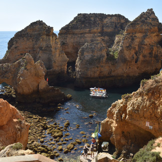
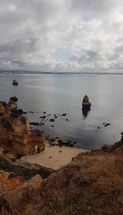
Ponta da Piedade is a true natural paradise. With its blue-green waters and unique cliff shapes sculpted by the sea and time, this idyllic landscape is characterized by a wide variety of caves, bays and small deserted beaches.
A short distance from the coastline there are several islets where you can observe different species of birds such as Peregrine Falcons, Crows, Gray-naped Crows or Swifts.
Go down the steps to a small cove where fishermen's boats take trips to the wonderful caves on the coast of Lagos.
The cliffs are essentially made up of biocalcarenites, with a great abundance of fossils. The erosion and fracturing of these ochre-toned rocks is very intense, and it is common to find structures characteristic of the karst model, namely sinkholes, caves and shallows.
The Ponta da Piedade Landscape-Cultural Route, the result of an intervention by the municipality with the construction of walkways and several viewpoints, is 2 km long and allows you to enjoy this stunning landscape in complete safety.
In Ponta da Piedade there was an old hermitage - the Chapel of Nossa Senhora da Piedade, which was a place of pilgrimage.

Our Lady of Piedade is one of the forms of worship of the Marian cult whose expression and image was widespread in our region. From the city to the hermitage, the various Steps of the Cross were built. The pilgrimage was carried out in procession, on foot. With the demolition of the hermitage, it began to be done, once a year, by boat, with larger fishing vessels, decorated and offering the trip to all who wanted to participate. Today it is a festival to be revived by the fishermen of Lagos.
On the right: The Steps of the Cross from the city of Lagos to the old Hermitage.
The hermitage was demolished for the construction of the Lighthouse, which dates back to 1913, in order to avoid obstacles to the view of the sea.
Next to the lighthouse we can see the lighthouse keepers' accommodation and, on the land in front, a cistern that receives rainwater collected by the roofs. The Lighthouse projects light approximately 20 nautical miles at a rate of 5 flashes every 10 seconds. Its height, above sea level, is 56.5 meters.

The beaches of Costa D'Oiro
Lagos has a stretch of coast known as Costa D’Oiro (Golden Coast), which gets its name from the color of the rocks and which includes some of the most beautiful beaches in the Algarve.
Let's now talk about the welcoming beaches with golden sands and calm, clear waters, nestled in the rocky lacework of this portion of the coast between Batata Beach and Ponta da Piedade.
Meia Praia beach
Although it is not one of the rocky beaches on the Costa D’Oiro, we could not fail to mention this well-known beach, with an extensive sandy area that runs along the entire bay of Lagos between the Lagos Marina and the Alvor Stream. From the north jetty of Ribeira de Bensafrim to the west jetty of Alvor Stream there is approximately 5 km of sand.
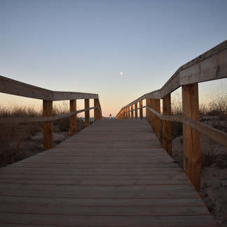
The walkways over the dunes facilitate better circulation for visitors, allowing the preservation of the rich dune vegetation. It is a good beach for water sports.
It was inspired by a community of fishermen that existed in Meia Praia, that José Afonso (an important singer and Portuguese composer), composed his single “Os indios da Meia Praia” , in 1976.
Batata beach

Just after Forte da Bandeira is the small sandy area of Cais da Solaria, where the Lagos Sailing Club is located, and where kayak trips depart to Ponta da Piedade.
After the south jetty of Ribeira de Bensafrim, there is Praia da Batata, the closest to the center of Lagos, equipped with various support facilities such as restaurants, toilets, etc.
It is a rocky beach, with a tunnel excavated in the rock that gives access to Praia dos Estudantes.
We recommend that you maintain a safe distance from the cliffs, due to the risk of landslides.
Estudantes beach
At Estudantes Beach, another tunnel gives access to a small cove with a unique perspective of an arched passage built to connect the cliffs and a shallow lake.
It is an unsupervised beach where we can find some plants characteristic of salt marshes such as the marsh marsh, the salt marsh, the valverde-dos-sapais, and also reeds, which denote the presence of freshwater.
Pinhão beach
Another unsupervised beach, which can be accessed via a pedestrian path from D. Ana beach on the cliffs.
The sand is divided in half by a rock formation with several arches and caves. The two sands are very small and almost completely disappear during high tide.
In the northern part, a viewpoint was built with a staircase leading down to the sea, access to which is currently closed due to the danger of collapse. Before this was fenced off, it was possible, during high tide, to dive into the sea directly from this structure.
Due to an extensive submerged rocky area, it is a good beach for snorkeling lovers.
The entire length of the beach is within the landslide danger zone.

D. Ana beach
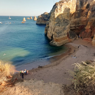
Set between rocky cliffs, Praia D. Ana was recognized by the Spanish magazine Condé Nast Traveler as the best beach in the world in September 2013 and voted the best Portuguese beach by TripAdvisor in 2015.
Due to the abundance of marine life in the rock formations, it is an excellent beach for snorkeling.
At the access to the beach, there is a viewpoint overlooking the various islets scattered on the horizon, which is a great place to take photos.
Recently, an artificial recharge intervention was carried out with sand from the bottom of the sea. With this intervention the beach lost some of its natural beauty but became safer for bathers.
The recharge of the sand partially buried some surrounding cliffs and shallows, destroying some of the seascape, marine ecosystems and important biodiversity of the intertidal zone.
Camilo Beach + Boneca beach
Camilo beach acquired its name because, at the top of the cliff that surrounds it, there is the restaurant O Camilo. It is beach divided into two small pockets - Camilo beach and Boneca beach. A huge rock formation divides the sand and it is possible to cross it through a narrow tunnel dug by hand.
Access to the beach is via a long staircase with around 200 steps. Before starting your descent, enjoy the stunning landscape of this beach between shell-shaped cliffs, with interesting rock formations, and clear, calm turquoise waters. From here you can see three islets close to the coast.
Porto de Mós + Canavial beach
Going up to the Miradouro da Atalaia, you get a magnificent view of this extensive beach, framed by high cliffs that offer protection against the northern winds. This viewpoint also offers a panoramic view of the entire coast up to Sagres.
The colors of the cliffs vary depending on the geological materials: the gray of the clays and the orange of the sandstones and limestones.

Luz beach
7 km from Lagos is this beach next to an urban center that is highly developed due to tourism. Vila da Luz was a fishing village, but nowadays it is mainly focused on family tourism, being a favorite holiday destination for English people and other nationalities.
The name originates from the Church of Nossa Senhora da Luz, which was seriously affected by the 1755 earthquake and rebuilt by the people.
The history of the village dates back to Roman times, which can be seen through the presence of the Roman Ruins of Vila da Luz, consisting of a spa for thermal activities and an industrial complex made up of fish salting tanks.
The Nossa Senhora da Luz Fortress located in Ponta da Calheta was built to protect tuna fishing traps and against pirate attacks. Next to the sea, there is a sidewalk, where visitors can walk and sit on benches with a picturesque view of the bay.
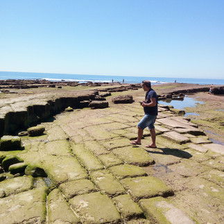
Luz beach is a rocky beach, full of pools with marine life, such as anemones, limpets, hedgehogs and sponges. On the rocky platform next to the fort, on the western side of the beach, there are many examples of marine fossils of Nerinea algarbiensis, a small marine snail.
On these rocky platforms we also find some cavities excavated in the rock called giant marmites.
In the eastern part of the beach, we can find a very dark rock, known as the Black Rock. It is an ancient volcanic chimney from a volcanic vein originating in the Serra de Monchique.
What to do in Lagos?
Hikes
Route between Lagos and Luz
Start: Lagos Railway Station
Final: Vila da Luz
Length: 11 km
D+ 177 m D- 185 m
Difficulty level: easy
Responsible entity: Rota Vicentina
This route can extend to Burgau or Salema, and corresponds to the last stages of the Fisherman's Trail
Caution is advised when walking on top of the cliffs.
Recommended time of year: September to June
More information at: http://pt.rotavicentina.com/
Pedra do Galo route
Start: Barão de São João Cultural Center
Pedestrian and cycling route
Type of route: circular (with a linear section of around 1km)
Length: 6.3 km
D+ 183 m D- 185 m
Difficulty level: easy
Responsible entity: Via Algarviana
Points of interest:
Barão de São João National Forest
Menhir of Pedra do Galo (Paleolithic)
National forest picnic park
Windmills
Espinhaço de Cão Mountain range
View of the Serra de Monchique
Temporary ponds
In Mata do Barão de São João there are other themed trails. The Figures Route allows you to appreciate the sculptures by the artist Deodato; the Poets Route, the poetry carved into the rocks and the A Ver o Mar route (Watching the Sea route), magnificent panoramic views that reach the sea. All of these routes begin and end at Largo da Igreja (Church Square), in the village of Barão de São João, a typical village, with residents coming from various parts of the world.
Route “Passeio das Figuras” – 2,2 Km
Route “A Ver o Mar” – 2,8 Km
Route “Passeio dos Poetas” – 7,0 Km
(unofficial routes)
Via Algarviana (Grand Route)
The Via Algarviana is a large route that starts in Alcoutim and ends in Cape of S. Vicente, and can also be done in the opposite direction. It crosses the entire Algarve interior, passing through traditional Algarve villages.
The municipality of Lagos is crossed to the North by 2 sectors of this Grand Route:
Sector 12 (Monchique/Marmelete – Bensafrim) – 30 Km
Sector 13 (Bensafrim – Vila do Bispo) – 30,19 Km
The Link 4 on the Via Algarviana, between Bensafrim and the Lagos Train Station (10.10 km) allows walkers to start, stop or finish their route on the Grand Route, ensuring accessibility to the city and public transport.
Find out more at: www.viaalgarviana.org
MTB Tours
At the Barão de São João Cultural Center, at the gates of the Barão de São João National Forest, there is also the new MTB Center or Cyclin’ Lagos Center. This center allows bicycle enthusiasts, both federated and leisure athletes, to follow several signposted and safe routes, with different distances and degrees of difficulty.
The route network has 9 different routes with 4 different levels of difficulty. In total there are 300 km signposted.
Boat or kayak trip to the caves
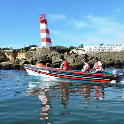
A boat or kayak trip along the Lagos Coast offers a privileged view of the fantastic caves and rock formations of the Costa D’Oiro.
The boat skippers, who are mostly experienced fishermen, go around the rock formations and enter the caves, revealing their names and revealing their secrets. Some of the names of these rocks and caves are: General De Gaulle, Chaminé, Catedral, Belas-Artes, Camelo, Museu, Submarino, Cozinha and Gruta dos Amores.
Kayak trips provide an unforgettable adventure navigating through the labyrinths of rock formations, allowing you to enjoy greater contact with the water and in a more ecological way.
Taste organic wine
The Quinta do Monte da Casteleja uses ancestral techniques such as "foot treading" and aging in barrels to create several organic wines. The harvest is done the old-fashioned way, with lots of celebration and entertainment.
On Tuesdays and Thursdays you can schedule a guided tour by a sommelier with wine tasting and snacks. It is a unique tasting experience, with snacks chosen especially to pair with the wines, made with local, organic and seasonal products. Visits are carried out in Portuguese, English and French.
Quinta do Monte da Casteleja location
Bath Party 29
One of the most popular traditions in Lagos is the night bath on the 29th of August. A party that is celebrated with lots of musical entertainment and historical recreations.
This tradition marks the end of summer and it is popularly believed that a nighttime swim on the 29th of August is purifying and “drives away demons”.
LAC - Creative Arts Laboratory
If you like contemporary art, pay a visit to LAC. LAC – Laboratory of Creative Activities is a cultural association based in the Old Prison of Lagos. In addition to promoting artistic residencies, it regularly offers training and workshops, exhibitions and other types of shows.
LAC is also a promoter of the ARTURb project, which involves some of the most important names in urban art, turning the city streets into an open-air museum.
Click here to see where the urban works are and plan your route.
Check the LAC schedule here: https://lac.org.pt
Bensafrim Stele

In the south of the Iberian Peninsula, several stelae were found, stone tablets with inscriptions, with southwestern writing. This form of writing was developed by pre-Roman people, in southern Portugal and Spain, in the Iron Age, around the 8th to 5th centuries BC.
Funerary stelae were placed in tombs with inscriptions that recalled the deeds of the deceased's life.
The Fonte Velha Stela was discovered at the end of the 19th century by archaeologists Estácio da Veiga and Santos Rocha in the necropolis of Fonte Velha in Bensafrim, one of the largest necropolises of the Iron Age, and, since then, it has been extensively studied.
A replica of the Stela can be found in Bensafrim Market Square. The original is in the Dr. Santos Rocha Municipal Museum, in Figueira da Foz. It was broken into three parts but has been restored. Other stelae that were found in this necropolis are located in the National Archeology Museum.
Activities for families and children
Lagos Live Science Center
Located above the Municipal Market, the Lagos Live Science center is a space of discovery, where various activities to explore the Algarve territory can be carried out, such as guided visits to the dinosaur footprints and Geology of Salema or the Santa beaches.
The permanent exhibition is called “From the Astrolabe to GPS” dedicated to the theme of Discoveries, navigation and other related more modern discoveries. Children especially love the submarine room where they can try sailing in a submarine.
Lagos Zoo
Lagos Zoological Park is an ideal place to visit with children. It consists of 3 hectares of land, where you can observe a large number of small primates and a children's farm with domestic animals.
This park is located near the village of Barão de São João, 13 km from Lagos. Urban transport in Lagos Onda is a good alternative to get to Lagos Zoo.
The main attractions are animal feeding (otters, primates, pelicans, penguins and lemurs), and an artificial beach with African penguins and the bat enclosure.
Gastronomy in Lagos

In Lagos you will easily find restaurants for all tastes, with Algarve, Portuguese and world food, as well as fast food or street food.
Here are some restaurant suggestions where you can taste typical Lagos dishes. Fish and seafood are, without a doubt, one of the strong points of local cuisine.
Some of the typical dishes are cataplana, octopus rice, xarém de conquilhas, razor clam soups, fed mackerel, stuffed squid, stews and barnacles.
Lagos has a huge tradition when it comes to sweets, which dates back to the time when the nuns of the Convent of Nossa Senhora do Carmo created the recipe for the famous dom-rodrigos, a convent sweet made from egg strands, almond kernels, cinnamon and sugar.
Finally, accompany your meal with a local wine, from Monte da Casteleja, or Herdade dos Seromenhos, and finish with arbutus brandy to aid digestion.





















Comments